GPR Surveying in Ware
Enquire Today For A Free No Obligation Quote
At GPR Surveying in Ware, we deliver accurate, non-invasive underground utility mapping using Ground Penetrating Radar technology.
Our services assist contractors, engineers, and site managers in Ware and throughout the UK in locating buried utilities before excavation, helping to minimise utility strikes, project delays, and unexpected costs.
Whether your project involves infrastructure improvements, site feasibility studies, or planning submissions, GPR surveying offers a reliable and efficient method for understanding subsurface conditions.
How Is GPR Surveying Used on Sites Around Ware?
In Ware, GPR surveying is applied to detect underground services where traditional electromagnetic methods may be ineffective, such as identifying plastic pipes, fibre-optic ducts, or utilities buried beneath reinforced concrete.
The process involves transmitting high-frequency radar signals into the ground and analysing the reflections that bounce back from subsurface anomalies, such as ducts, tanks, or voids.
GPR surveying is a vital tool for construction zones, urban infrastructure projects, and any site where precise utility data is required.
What Types of Underground Services Can Be Detected Using GPR Across Ware?
A GPR surveying program in Ware can uncover a diverse range of subsurface features, including:
- Plastic and clay water pipes – Commonly undetectable by electromagnetic techniques.
- Empty ducts and conduits – including unused fibre-optic channels or service voids.
- Fibre-optic cables – Non-metallic infrastructure that is invisible to standard locators.
- Drainage runs and stormwater pipes – Mapping of buried drainage and flow systems.
- Voids and air pockets – Identifying subsurface gaps or potential sinkhole zones.
- Underground tanks and chambers – Detection of hidden structures like oil tanks or vaults.
- Metallic cables and pipes – Radar detectable in appropriate ground conditions.
- Changes in sub-base materials – Highlighting construction layers beneath surfaces.
- Unknown foundations or footings – Tracing undocumented or legacy structural remains.
How Much Does Ground Penetrating Radar Utility Mapping Cost in the Ware Area?
The cost of GPR surveying in Hertfordshire ranges from £600 to £2,000+, depending on factors such as site area, radar frequency requirements, and the complexity of the subsurface.
Pricing is also influenced by factors such as soil type, post-processing requirements, CAD deliverables, and whether PAS 128 compliance is required.
Contact GPR Surveying in Ware for a customised quote specific to your site’s detection needs.
When Should You Use GPR for Utility Detection Near Ware?
GPR surveying is efficient in Ware on sites with non-metallic utilities, congested service corridors, or reinforced structures that limit the performance of electromagnetic tools.
It’s also suited for areas where invasive methods are restricted, such as protected urban environments or heritage sites.
GPR should be used when high-resolution data is needed to supplement utility records, confirm unknown features, or validate service locations before any excavation begins.
How Accurate Is GPR Surveying for Projects in or Around Ware?
GPR surveying in Ware generally offers horizontal accuracy ranging from 100mm to 300mm, depending on the ground type, surface conditions, and radar resolution.
Depth estimates are typically accurate within 10–15% under favourable conditions such as dry or sandy soils.
However, dense clay, high moisture content, or reinforced concrete may reduce signal quality and clarity of detection.
What’s the Difference Between a Standard Utility Survey and a GPR-Based Scan?
GPR surveying offers enhanced detection capabilities compared to standard utility surveys, which typically rely on electromagnetic methods that are limited to detecting metallic or conductive services.
GPR, by contrast, uses radar to detect both metallic and non-metallic elements, as well as voids and structural anomalies.
While electromagnetic surveys trace linear paths, GPR offers depth profiling and contextual information around buried utilities, making it suitable for complex or undocumented underground conditions.
Can GPR Surveying Be Performed on Live Construction Sites Within Ware?
GPR surveying can be safely conducted on active construction sites in Ware. The method is completely non-destructive and poses no interference to site operations or personnel.
Our survey teams in Ware are equipped with appropriate PPE and follow strict health and safety protocols, including risk assessments and method statements.
Surveys can be scheduled to align with ongoing site activity, ensuring minimal disruption and rapid turnaround.
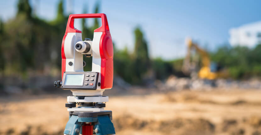
What Equipment Is Used for GPR Utility Mapping Conducted Near Ware?
For GPR surveying projects in Ware, we use industry-leading systems and accessories tailored to project conditions:
- Single-frequency and dual-frequency antennas – Selected for optimal depth or resolution as required.
- Wheeled or cart-based GPR units – Efficient scanning solutions for flat or varied terrain.
- IDS Stream C and Leica DS2000 – Proven radar systems used across the construction and civil sectors.
- GPS and total station control – For accurate geo-referencing of utility positions within the site.
- Specialist post-processing software – Converts radar data into clear, usable subsurface maps.
- Custom equipment configurations – Adjusted based on site layout, target utility type, and surface materials.
Are GPR Surveys in Ware PAS128-Compliant and Suitable for Legal Documentation?
GPR surveying in Ware can be delivered in full compliance with PAS128 standards. GPR is classified under Method M3 or M4, depending on whether it is the primary or supporting detection method in a Type B survey.
Our surveyors in Ware follow PAS128 protocols to assign quality levels to all findings and compile structured documentation and CAD outputs.
These deliverables are suitable for planning applications, design validation, risk assessments, and use in legal or contractual records where formal utility mapping is required.
Contact GPR Surveying in Ware to schedule a consultation and ensure full compliance for your next utility mapping project.
Find More Info
Make sure you contact us today for a number of great GPR Surveying services in East of England.
Here are some towns we cover near Ware SG12 9
Hertford, Hoddesdon, Broxbourne, Essex, HarlowFor more information on GPR Surveying in Ware SG12 9, fill in the contact form below to receive a free quote today.
★★★★★
I couldn’t be more impressed with GPR Surveying. Their team was prompt, professional, and took the time to explain every step of the process. Thanks to their expertise, we avoided costly delays on our construction project. I especially appreciated how thorough their reports were—easy to understand and very detailed. It’s rare to find a company that combines technical skill with such great customer service. I highly recommend them to anyone in need of accurate surveying
Laura Whitmore
Hertfordshire
★★★★★
GPR Surveying exceeded all my expectations from start to finish. Their crew showed up on time, worked efficiently, and identified subsurface issues that saved us from future headaches. What stood out to me was their clear communication and honest recommendations. You can tell they take real pride in their work. I’ve already recommended them to several colleagues in the industry
Marcus Feldman
Hertfordshire